
 Livery Dole
Page updated 1st June 2018
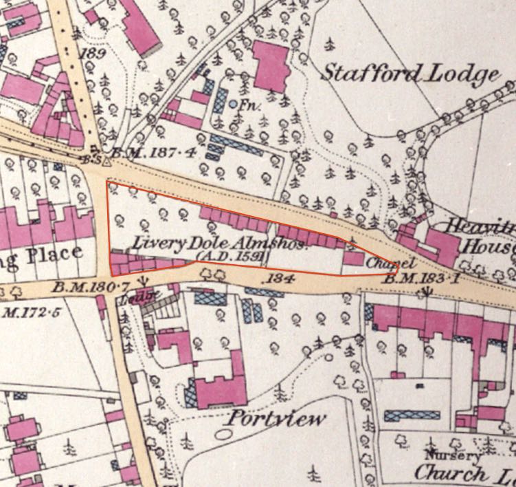 This is a triangle of
land between Heavitree
Road,
Polsloe Road and Magdalen Road. From the Old English Leofhere who
owned the land and dole, meaning a piece of land. An article in the Flying Post in 1848 stated
that the first mention of Livery Dole was in a deed of 1 August 1278,
and again in an Act of Parliament in 1437. Henry VI was met by
clergymen from Exeter, clothed in their copes and vestments, at Livery
Dole in 1452.
This is a triangle of
land between Heavitree
Road,
Polsloe Road and Magdalen Road. From the Old English Leofhere who
owned the land and dole, meaning a piece of land. An article in the Flying Post in 1848 stated
that the first mention of Livery Dole was in a deed of 1 August 1278,
and again in an Act of Parliament in 1437. Henry VI was met by
clergymen from Exeter, clothed in their copes and vestments, at Livery
Dole in 1452.
Livery Dole was used as a place of execution for those who committed murder, witchcraft, heresy or treason up until 1537 when the City of Exeter became a county in its own right. In August 1431, Drew Steyner was burnt at the stake at Livery Dole while a hundred years later, in 1531, Thomas Benet, the Protestant Martyr was the last to die there.
The almshouses
The almshouses were founded by Sir Robert Dennis in 1591 and completed by his brother, Sir Thomas Dennis in 1594, it is said, in penance for the execution of Benet by their ancestor, Sir Thomas Dennis, Sheriff of Devon in 1531. The almshouses, for twelve aged men, consisted of a single low room with a chamber over, and a small plot of land for a garden. In addition, each inhabitant was paid twelve-pence per week, and supplied with a gown and a hundred faggots yearly. Dennis built St Clare's Chapel for the men's spiritual needs and a chaplain to read prayers, and dedicated to Saint Clarus, an English missionary martyred about 894, in Normandy. The chapel was built on an existing Chantry Chapel, built between 1418 and 1439, that was used to pray for the souls of the executed – the place of execution was just in front of the chapel in the gardens of the almshouses. A rent of 1d per year was paid to the lord of the manor of Heavitree for the Livery Dole Hospital.
By 1823, the almshouses consisted of ten dwellings inhabited by ten poor men or women and a house for the chaplain. Income from an estate of 1,500 acres at Winterbourne Whitechurch, owned by Mr Compton a descendent of Sir Thomas Dennis, paid for the upkeep of the almshouses and the chaplain. Lord Rolle, another descendent of Sir Thomas paid for the repairs to the almshouses, and also appointed candidates when a vacancy arose, and appointed the chaplain.
In 1848, the almshouses were rebuilt by Louisa, Lady Rolle (1794–1885), a direct descendent of the Dennis family. While the new almshouses were being built, a reward of £10 was offered for the names of those who had vandalised the partly built structure. The next year, the newly completed dwellings were visited by Lord Rolle. The new buildings did not meet with everyone's approval, and a scathing letter in the Flying Post in December 1849 castigated the planners and architects for erecting a "deformity and disgrace".
There was a Stop Gate in 1800 at Livery Dole, part of the Exeter turnpike system and in 1829, the Heavitree toll-house was moved to Livery Dole. At the meeting discussing the Chief Constable of Devon's report in 1884, Sir John Duckworth proposed that the toll-house be rented for the use of a police constable. A sum of £50 was allocated for repairing the building in preparation.
At the point of the triangle, where Magdalen Road and Fore Street, Heavitree meet, can be found a Victorian lamp post cast by Garton and King in Waterbeer Street. The inscription that reads:
CHARLES GEORGE GORDON 26TH JANUARY 1885
General Gordon who was killed in the siege of Khartoum in 1885, was a close friend of the Heavitree vicar, Prebendary Barnes, father of Dame Irene Vanbrugh. Barnes was deeply upset at Gordon's death and paid for the memorial. General Gordon had family connections with Exeter and his father is buried in the St Thomas churchyard.
Sources: Concise Account of the City of Exeter by Shirley Woolmer, Flying Post, Transactions of the Exeter Diocesan Architectural Society 1853 and others.

The old almshouses were situated on Magdalen Road before 1848.
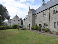
The new Livery Dole almshouses from the Heavitree Road side. Photo Sarah Charlesworth, Creative Commons
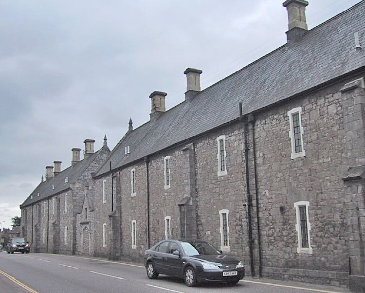
The almshouses from the Magdalen Road side. The place of execition was roughly were the gate in the wall was situated.
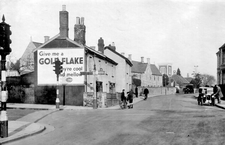
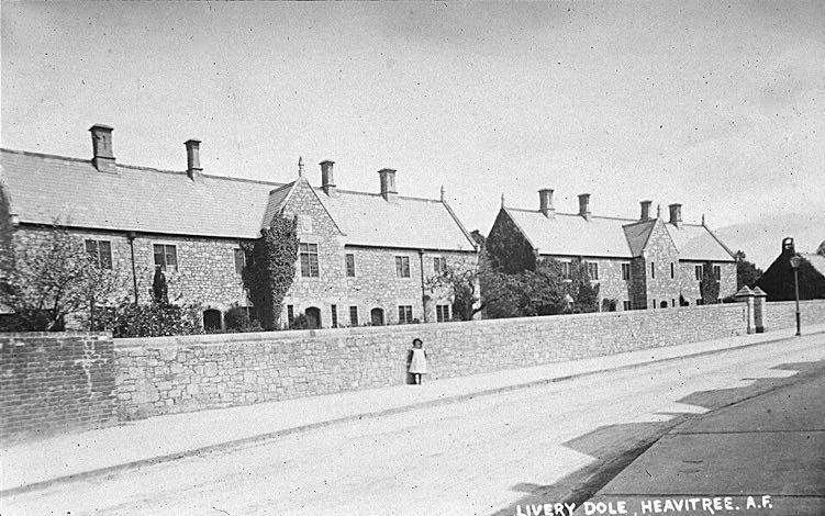
Livery Dole from the Magdalen Road, Barrack Road junction in the 1930s.

St Clares in the 1960s.
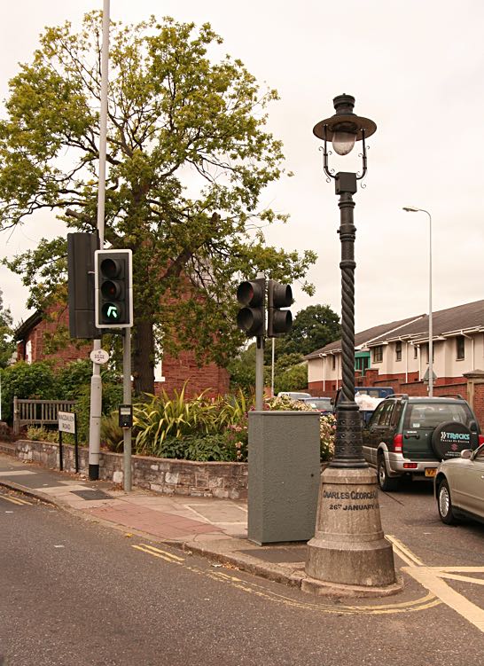
The Gordon Lamp at the apex of Livery Dole.
│ Top of Page │