
Egypt Lane
Page updated 21st March 2018
 This small lane, beside St
Catherine's Chapel forgotten until the redevelopment of
Princesshay, has a very long history. Some think that the lane was originally laid out at the time of Alfred the Great in the 9th Century.
This small lane, beside St
Catherine's Chapel forgotten until the redevelopment of
Princesshay, has a very long history. Some think that the lane was originally laid out at the time of Alfred the Great in the 9th Century.
Reference to the lane next appears with the name Strikenstrete (c1265), and later Styckestreete (1458). There is some confusion, for it was also named Freren Lane during this period.
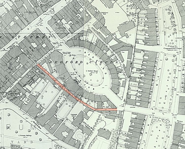
The Cathedral authorities gained permission in 1286 to build a wall with seven gates around Cathedral Close. Earlier, the Dominicans, in the 1240's, built a friary and enclosed the building and their church with a wall in the area of the modern Bedford Street. The two walled areas of ecclesiastical land of the friary and Cathedral Close, effectively cut off the city wall from below Eastgate to Southgate from the citizens of Exeter for maintenance. In 1297, Edmund, Earl of Cornwall announced that the Dominicans and Cathedral must share the use of Freren Lane with the city authorities for access to the wall. The lane ran from Catherine Street, alongside St Catherine's Almshouses to the city wall at the Crolditch (Southernhay).
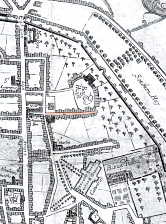 This map shows Egypt Lane in 1709. Black Friars land and priory are to the north. Hoskin's was puzzled by the name and thought it may be derived from a
slang term. A letter in 1907 to the Exeter and Plymouth Gazette suggested that it was so named because the city allowed gypsies to encamp there. Gypsies were thought to have originated in Egypt. The archeologist, Miss Lega-Weekes, thought the lane was briefly known as Theatre Lane, after the theatre in Bedford Street that opened in 1787. A lease of 1814 strangely refers to it as Johnasses Lane.
(D&CN&Q) By 1848, the lane was renamed Chapel Street, presumably because there was a rear entrance from the Bedford Chapel into the lane.
This map shows Egypt Lane in 1709. Black Friars land and priory are to the north. Hoskin's was puzzled by the name and thought it may be derived from a
slang term. A letter in 1907 to the Exeter and Plymouth Gazette suggested that it was so named because the city allowed gypsies to encamp there. Gypsies were thought to have originated in Egypt. The archeologist, Miss Lega-Weekes, thought the lane was briefly known as Theatre Lane, after the theatre in Bedford Street that opened in 1787. A lease of 1814 strangely refers to it as Johnasses Lane.
(D&CN&Q) By 1848, the lane was renamed Chapel Street, presumably because there was a rear entrance from the Bedford Chapel into the lane.
The stables of the New Inn, the largest and most important in the city in the 16th and 17th centuries were situated on the opposite corner to St Catherine's Almshouses and Chapel, at the entrance to Egypt Lane. In the 19th Century, even the Royal Clarence had stables in Egypt Lane.
The Streets Committee considered improving Martins Lane, Catherine Street and Egypt Lane in the 1870s with a view to making the theatre more easily accessible, alongside an alternative route along Bedford Street. There were two deaths from the cholera in 1832, who lived in Egypt Lane–both appear to be from St Catherine's Almshouses.
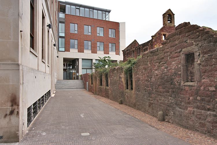
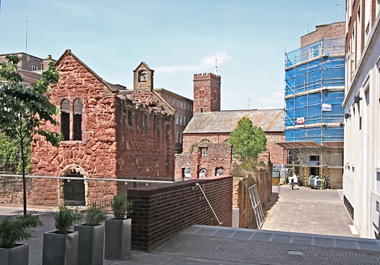
The rebuilding of the area during 2005 re-opened a right of way alongside the ruins of St Catherine's Chapel, following the line of the old Egypt Lane. It passes under Norwich Union House, and past Wagamama, a Japanese restaurant. The developers have named it Egypt Lane, a welcome return for an old right of way.
Looking down Egypt Lane from St Stephen's Square.
Looking towards St Stephen's with the remains of St Catherine's Almshouses on the left.
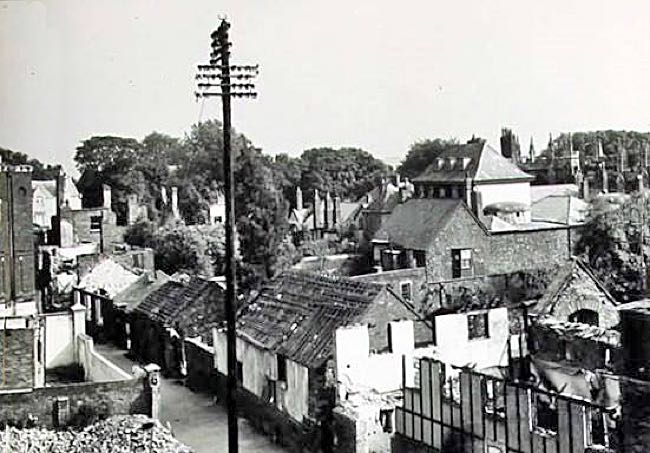
Looking down Egypt Lane just after the blitz. The roofless St Catherine's Chapel is on the right

St Catherine's Almshouse with Egypt lane running down the side.
│ Top of Page │