
The 1960s Floods - some new photos
October and December 1960
Page updated 18th October 2010
Back to Photo Essays
There were many photographs taken of the October and December floods in Exeter, during 1960. Most of this selection of photographs have never been published before. Included are the only quality colour photographs that I have seen, showing the oil stained red-brown water on both sides of the river.
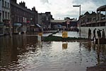 At
the end of Cowick Street, near the Exe Bridge, people stood around on
small islands of slightly higher ground, waiting to be rescued. Some
just plunged in and waded home. The rebuilding of the street on the
right hand side is in progress, while the left side, where the modern
library is located, has still to be demolished. Photo taken by Clifford
Stanton.
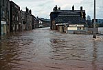 There are several dramatic
photographs from this viewpoint along Okehampton Street, but this is
the only colour one I have come across The Royal Oak public house, that
lost the famous beer barrel is behind the large building on the right.
Photo taken by Clifford Stanton.
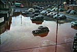 The oil streaked muddy red
water, in this photograph looking down on Exe Island does not look
very pleasant. Now, some of the cars would be a star attraction at a
veteran car rally. The photographer was probably hanging out of a
window of one of the buildings that were in front of the Mission Hall
(Plumb-In Centre). The Frog Street tunnel is to the left. Now, this is
the section of Frog Street between the northern bridge and the Bridge
Street underpass. Photo taken by Clifford
Stanton.
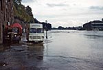 St Thomas and Exwick took the brunt of
the floods, but property on the Exeter side of the city also suffered.
Here a Frank Tucker, Westbrick lorry and an Initial Laundry van are
caught on the Quay. Photo taken by Clifford Stanton.
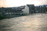 New The photo by Clifford Stanton of Okehampton Street in flood, above, appears to have been taken from the middle of the deluge. This photo shows the rise of Okehampton Street as it meets the junction by the Exe Bridge from which the photo was taken. It is covered by spectators keen to see the swirling waters. Nowadays there would be police and barriers to keep the public away. Photo taken by Tony Melhuish.
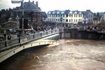 New Exe Bridge was a barrier to the flood waters. It was a popular place for spectators to watch the progress of the floods. This photo shows the bridge with St Thomas on the other side. Photo taken by Tony Melhuish.
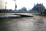 New Another colour view of the Exe Bridge, lined with curious onlookers, as the flood raged through St Thomas. Photo taken by Tony Melhuish.
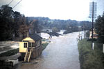 New Tony Melhuish travelled from Exeter to Crediton but had to return via, Bickleigh and Cowley due to the rising floods closing the main road. This journey showed him that the Creedy was already in full flood before the Exe flood waters had reached Exeter from the Exe catchments area. He thinks the combined rivers ultimately overwhelmed the city’s river defences. This photo shows the Exe spreading out over the flood plain and engulfing the railway. Photo taken by Tony Melhuish.
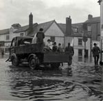 The next six photographs where taken by
Raymond Hall, and have also have never been published before.
A small flatbed lorry carries people from Cecil Road into flooded
Cowick Street. The lorry is pointing towards Buller Road. Photo
courtesy of Raymond Hall.
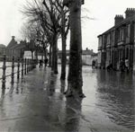 This
photo shows Gervase Avenue with the old malt house in the background.
The water is barely over the bank, but it has flooded the ground floors
of the houses. Photo courtesy of Raymond Hall.
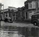 Alphington Street didn't escape the
flooding and cars can be seen passing Pikes Garage, on the left. Photo
courtesy of Raymond Hall.
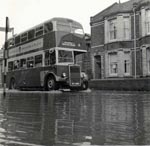 A City of
Exeter bus also passes Pikes Garage on the way to Marsh Barton Road.
Photo courtesy of Raymond Hall.
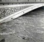 This photographs shows quite clearly
why the old Exe Bridge was removed in 1971, as the waters back up
against the iron archway. The modern bridges are designed to allow the
smooth passage of water under them at times of flood. Photo courtesy of
Raymond Hall.
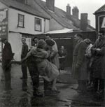 The
last photograph from Michael Hall's father shows a soldier carrying a
woman to dry ground, as the other gentlemen look on. It is thought to
be Church Street, St Thomas. Photo courtesy of Raymond Hall.
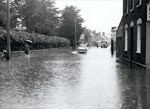 A view of Cowick Street with the St
Thomas churchyard on the left. The water is quite deep this far
from the river and it is still raining hard.
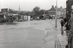
 Looking back down Cowick Street
towards the area where the photo left was taken. The water has not yet
reached this far, although the man on
the bicycle is not going to risk it. Householders look on anxiously,
hoping that the water does not come any further along the street.
 This photograph is taken in
Okehampton Road, just below Redhills Hospital. The post office is a
dozen steps further down, on the right. This was the limit of the water
in the road, as the ground starts to rise towards the hospital. Photo
Exwick Local History Group.
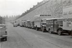 Things were just as bad at Exwick,
with some parts almost 2 metres under water. The Hill, Palmer and
Edwards 'Mothers Pride' bakery was under water, causing their fleet of
lorries and vans to park up on Exwick Road from Foxhayes towards the
cemetery. Photo Exwick Local History Group.
 These two shops at Valley Road, which
was the entrance to the Exwick bakery, are well under water. Photo Mike
Ewing.
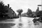 Looking in the other direction
from the shops at New Valley Road towards Foxhayes, there is a fire
engine standing by, although it would have been useless for pumping
until the water started to drop. Photo Mike Ewing.
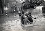 The British, as an island race have
always been fond of boating. Here, folk from Exwick are rowing up
Station Road and checking when the next church service is due! Photo
Exwick Local History Group.
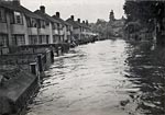 Looking more like a canal than a
road, the Exwick Road by Exwick Villas is in full flow. Although the
two floods of 1960 were particularly bad, this was a quite common
occurrence in Exwick, and almost yearly, the occupiers of these houses
had to dry out. Photo Exwick Local History Group.
│ Top of Page │