
Maps of Exeter
Page added 21st January 2019
I have tried to select the largest version of each map I can up to a maximum practical size. Not all devices will show them at maximum size, so on a smartphone, tablet or PC, zoom up.
Back to Photo essays
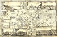 Rocque's
map 1744
Jean (John) Rocque was a French Huguenot brought to England soon after
his birth, circa 1709. He became a cartographer, surveyor engraver and
map seller. His map of Exeter from 1744 was two years before his
possibly greatest work, a map of London. He was noted for including
drawings of major buildings around the edges of his maps.
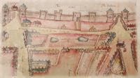 Southernhay
1590
This coloured map show Southernhay in 1590. The small lakes on
Southernhay Green indicate that the area was considered to be a
recreational area outside of the city wall. Included are details of the
towers and South and East gate along the city wall.
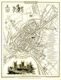 1806
Exeter
This 1806 map shows some decoration around the map, with an engraving of
te Cathedral and the City Coat of Arms. A limited key to notable
buildings is to the right.
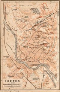 Wagner
Debes map of the city
The German cartography company Wagner Debes, from Leipzig, was
established in 1835. This example of their work shows Exeter, is just
after 1905 when the Buller Statue was unveiled.
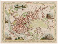 Map
by John Tallis 1851-1854
John Tallis with his brother Frederick produced maps between 1842 and
1849 when the partnership was dissolved. Tallis continued as John Tallis
and Co. This is an example of his work from between 1851 and 1854, and
uses the old Rocque's technique of showing views of local buildings
around the edge.
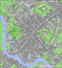 Based
on 1905 OS
The Ordnance Survey started producing local maps in the 19th Century.
This map, that I produced, is based on the 1890-1905 series. I have
redrawn and coloured it for clarity, using the OS symbols as a guide.
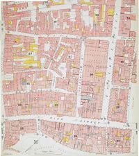 Insurance
map Central Exeter
A series of detailed insurance maps of the city were produced in the
late 19th and early 20th Centuries. This, probably from about 1900,
shows St Martins' Island at the bottom edge up to Paul Street
at the top. The Higher Market, police station and St Pancras Church can
all be found.
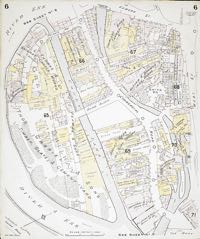
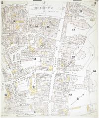 Insurance
map of South Street
This insurance map of South Street and its environs, shows some streets
that were lost in the blitz. This map indicates use that each building
was put to, at the time of compiling the map.
 Insurance
map Shilhay
Shilhay and Commercial Road are included in this insurance map. Bodley
Bros foundry, Tremletts Tannery and Cricklepit Mill canal be found on
the map.
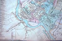 St
Thomas before the railway
I am not sure who produced this map, but I have included this section of
it because it shows an accurate St Thomas from before the railway.
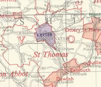 St
Thomas Union
The city in the centre, coloured purple, is surrounded by St Thomas
Union, bounded by the red line. The Union stretched from the Exmouth
boundary in the south east to Tedburn St Mary in the north west. If you
were found to be destitute from anywhere in the union, you could end up
in the workhouse off Okehampton Road.
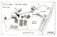 Cattle
market 1939
This map was in the special program for the opening of the cattle market
in 1939. The abattoir was never built at this location.
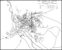 Bomb
hits May 1942
A map showing where each bomb hit, on 4/5th May 1942.
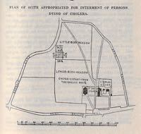 Bury
Meadow cholera map
The map of Bury Meadow published in Dr Shapters, 'History of the Cholera
in Exeter'. The map was included as it shows where the cholera burial
ground was located in Bury Meadow. It is actually under the children's
play area.
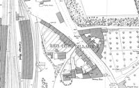 Red
Cow area
The small hamlet of Red Cow gained importance when the railway came to
Exeter from Bristol, and became the terminus now known as St David's
station. The small rectangular building, centre top, had been the toll
house.
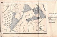 Marsh
Barton
A map, possibly from the 1950s, of the embryonic, Marsh Barton trading
estate.
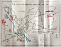 Exeter
Working Mens' Dwelling Co map
Published about 1935, this map shows the location of all the social
housing provided by the Exeter Working Mens' Dwelling Co,. which
eventually became Cornerstone.
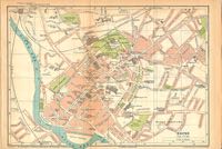 Bartholomew
map
A city map published by John Bartholomew and Son, probably from the
1920s.
│ Top of Page │